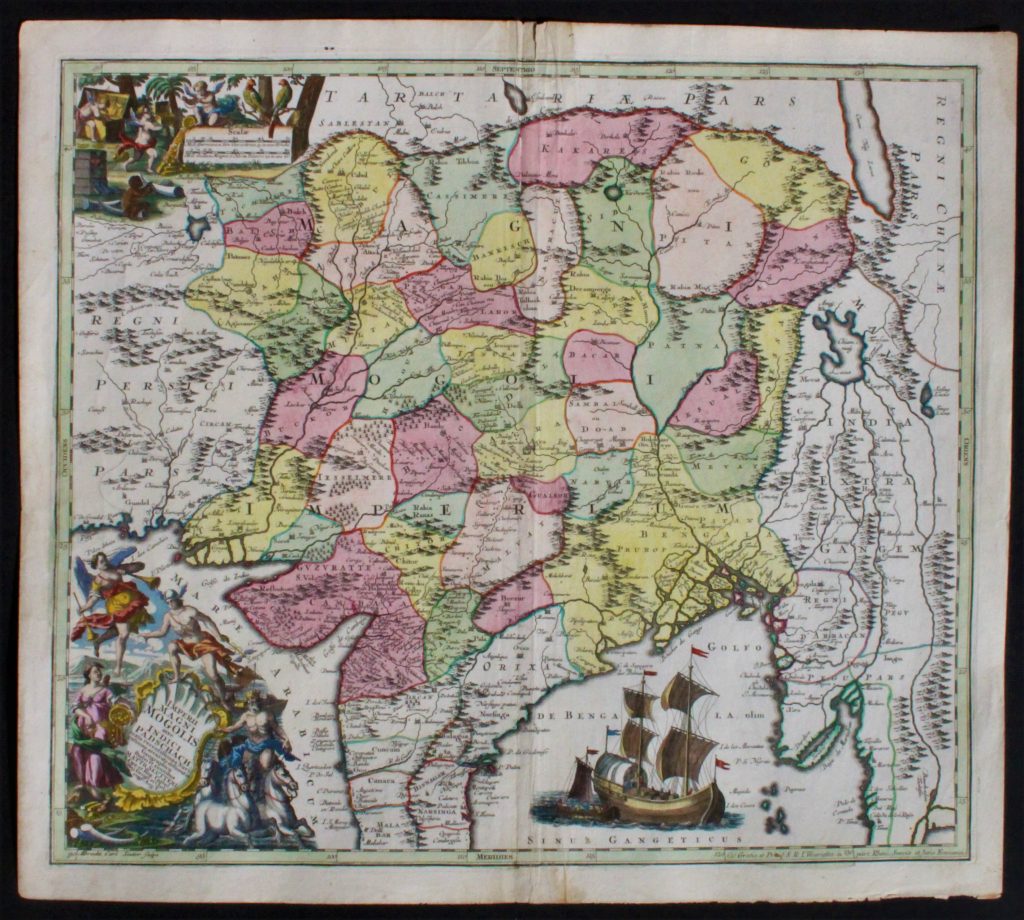
Imperii Magni Mogolis sive Indici Padschach.
Handcolored copperengraving, contemporary coloring.
Condition: Good som folding around the centrefold. Good margins
By: Matthäus Seutter
Publication Date: ca 1730
Price: € 550
xxxxxxxxxxxxxxxxxxxxxxxxxxxxxxxxxxxxxxxxxxxxxxxxxxxxxxxxx
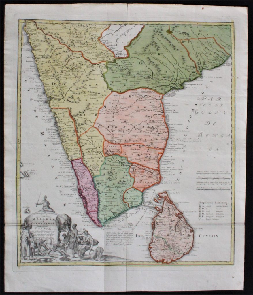
PENINSULA INDIAE CITRA GANGEM HOC EST ORAE CELEBERRIMAE MALABAR & COROMANDEL CUM ADJACENTE INSULA NON MINUS CELEBRATISSIMA CEYLON.
Handcolored copperengraving
By: Homann Heirs
Dated in the map 1733, cum privilegio later state ca 1750
Condition: good, folded as published
Price: € 450
xxxxxxxxxxxxxxxxxxxxxxxxxxxxxxxxxxxxxxxxxxxxxxxxxxxxxxxxxxxxxx

India
Frederik de Wit /
Editie Covens en Mortier
Techniek: handgekleurde kopergravure
Conditie: uitstekend, met vouw zoals uitgegeven.
Ca 1750
Prijs: € 600
xxxxxxxxxxxxxxxxxxxxxxxxxxxxxxxxxxxxxxxxxxxxxxxxxxxxxxxxxxxxxx
Het aziatische deel van Turkije
Door Nicolaas Visscher
Oudgekleurd
Conditie: uitstekend
door oude kleuring marginale papiervraat
Price: sold
xxxxxxxxxxxxxxxxxxxxxxxxxxxxxxxxxxxxxxxxxxxxxxxxxxxxxxxxxxxxxx

Provinciarum Persicarum
Chirvan & Dagestan
(Caucasus)
Johan Baptist Homann
18e eeuw
Zeer fraai gekleurde kopergravure
€ 475
xxxxxxxxxxxxxxxxxxxxxxxxxxxxxxxxxxxxxxxxxxxxxxxxxxxxxxxxxxxxxxxxxxxxxxxxxxxxxxxxxxxxx

Noord-India / Tibet
Himalaya
Land van herkomst: verm. Italië
Gebaseerd op kaart Ptolemeus
Verso: tekst latijns
Datering: ca 1597
Moderne kleuring
Prijs: € 175
xxxxxxxxxxxxxxxxxxxxxxxxxxxxxxxxxxxxxxxxxxxxxxxxxxxxxxxxxxxxxxxxxxxxxxxxx

India / Bengalen
Bangladesh
Door: Brion de la Tour
(1756-1823)
Modern handgekleurd
Datering ca 1788
Prijs € 125
xxxxxxxxxxxxxxxxxxxxxxxxxxxxxxxxxxxxxxxxxxxxxxxxxxxxxxxxxxxxxx
INDIA WEST COAST CARTE DES COSTES DE PERSE,GUZARAT ET MALABAR
Door: J. van Schley (1715-1779) (Kaart linksonder gemonogrammeerd J.V.S.)
Cartograaf: Jacques Nicolas Bellin (1703 – 21 March 1772)
From: Antoine-François Prevost’s monumental 20 volume edition of L`Histoire Generale des Voyages.
Datering: 1747 Amsterdam
Afmeting ca: 25 x 19,5 cm
Condition: Good, Small tear in left margin, not affecting the image,
with folds as published.
Uncommon edition of this accurate map showing the east coast of India, the Maldives Islands and the eastern tip of Arabia.
Price: € 90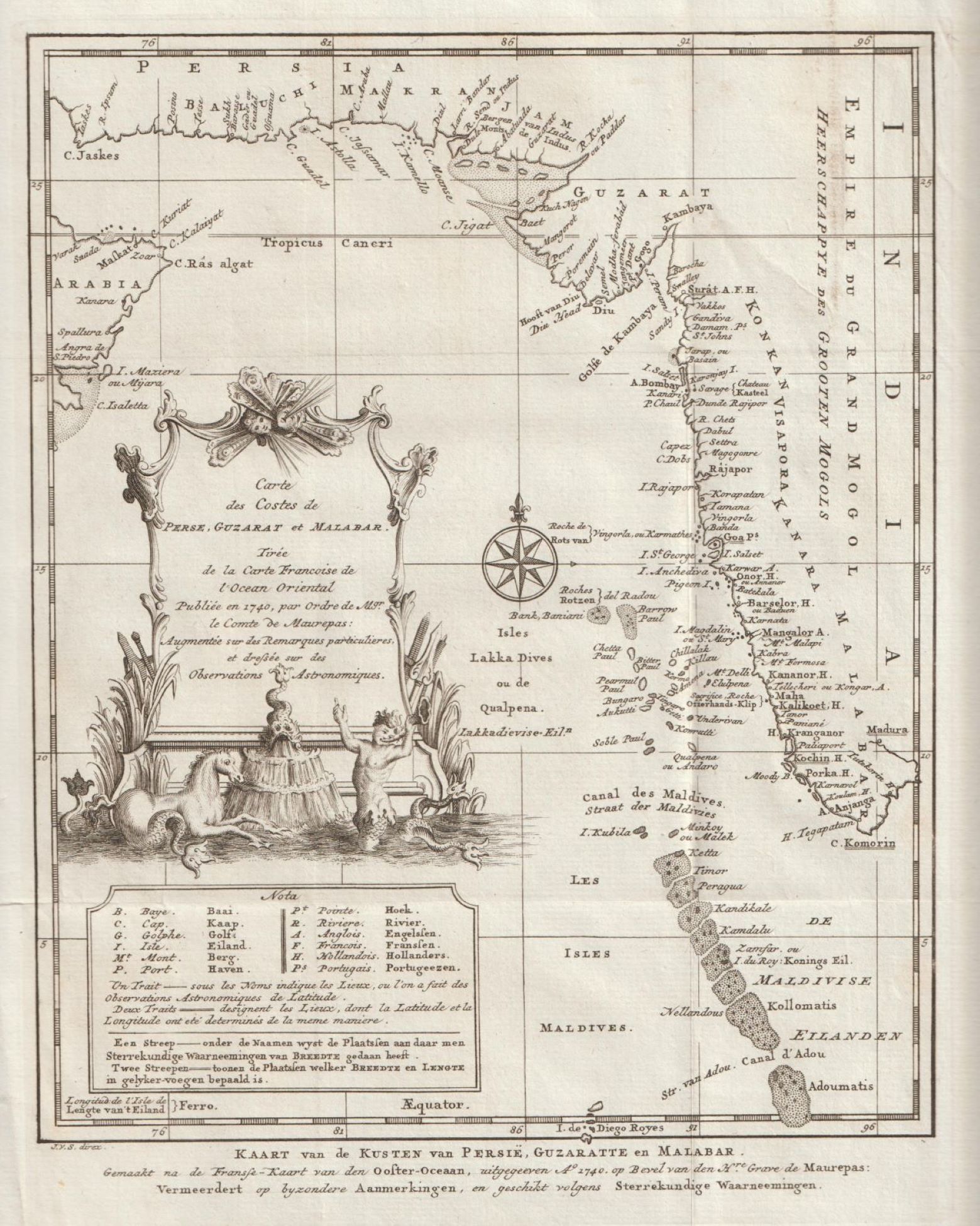
xxxxxxxxxxxxxxxxxxxxxxxxxxxxxxxxxxxxxxxxxxxxxxxxxxxxxxxxxxxxx