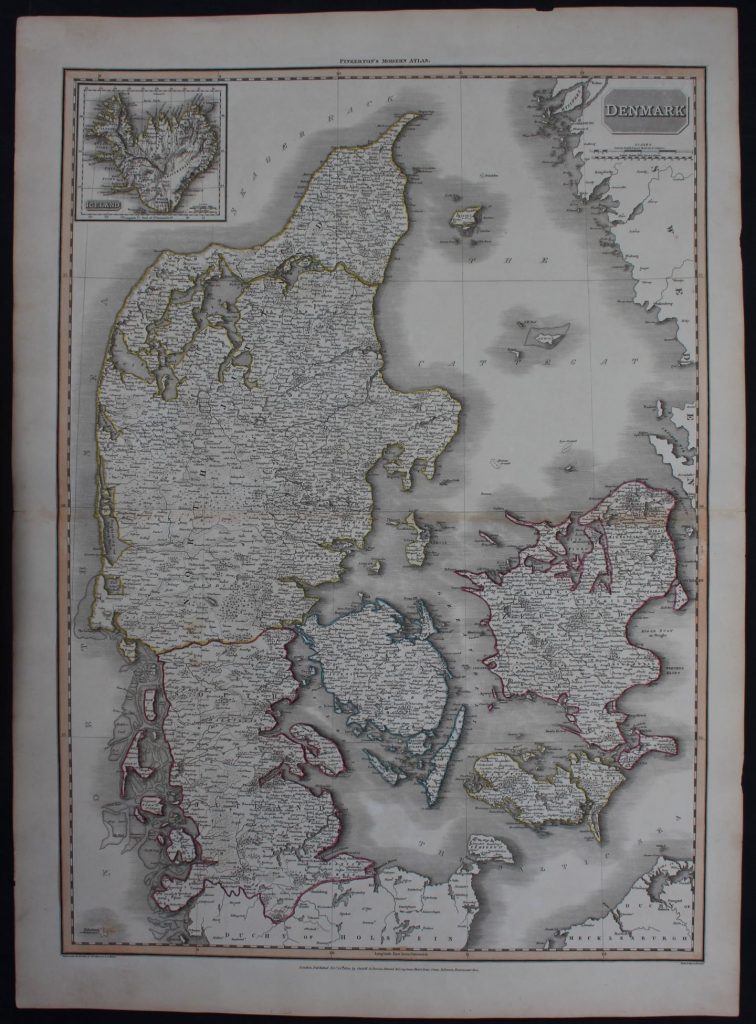
Gedetailleerde kaart van Denemarken en IJsland.
Gegraveerd door: Neele, Samuel John, 1758-182
Uit: A modern atlas, from the latest and best authorities, exhibiting the various divisions of the world, with its chief empires, kingdoms and states, in sixty maps, carefully reduced from the largest and most authentic sources. Directed and superintended by John Pinkerton, author of Modern geography, &c. London: Printed by T. Bensley, Bolt Court, Fleet Street; for T. Cadell and W. Davies, Strand; and Longman, Hurst, Rees, Orme, And Brown, Paternoster Row.
Door: Pinkerton, John, 1758-1826
Detailed map of Denmark and inset map of Iceland
Sheet size: 56 x 78,5 cm
Year: 1812
Technique: copper engraving
Price: € 120
Condition:
Very good condition, hand colouring on the borders. Fold as published.
xxxxxxxxxxxxxxxxxxxxxxxxxxxxxxxxxxxxxxxxxxxxxxxxxxxxxxxxxxxx
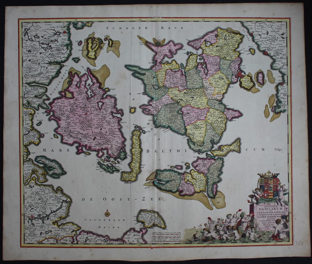
Insularum Danicarum ut Zee-Landiae, Fioniae, Langelandiae, Lalandiae, Falstriae, Fembriae, Mona aliarumq in Mari Balthico Sitar Descriptio
By: F. de Wit, Amsterdam
Copper engraving
Condition: Excellent, strong original colours inlcuding the cartouche, folded as published
Date: 1680
Price: € 550
xxxxxxxxxxxxxxxxxxxxxxxxxxxxxxxxxxxxxxxxxxxxxxxxxxxxxxxxxxxxxx
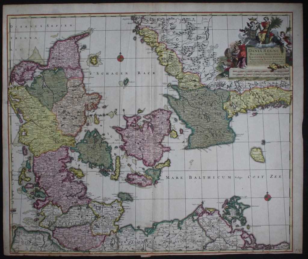
Dania Regnum, Ducatus Holsatia, Slesvicum, cInsulae Danica
Door: Daniel de La Feuille (1640-1709)
Date: ca 1700
Copper engraving
Condition: good, lower margin very short, strong original colours, folded as published
Price: € 375
xxxxxxxxxxxxxxxxxxxxxxxxxxxxxxxxxxxxxxxxxxxxxxxxxxxxxxxxxxxxxx