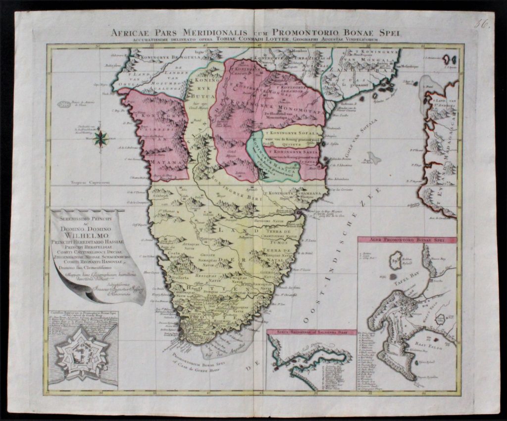
Zuid- Afrika
Africae Pars Meridionalis cum Promontorio Bonae Spei
Handcolored Copperengraving, modern colouring
By: Tobias Conrad Lotter
(Tobias Conrad Lotter (* 1717; † 14. Juli 1777 Begräbnis)
Date: ca 1750
Condition: Excellent, folded as issued, with wide margins
Price: € 350
xxxxxxxxxxxxxxxxxxxxxxxxxxxxxxxxxxxxxxxxxxxxxxxxxxxxxxxxxx

Afrika
Caroli Allard
Kopergravure, oudgekleurd
kaartbeeld + cartouche
Zeer fraaie kaart met vouw
zoals uitgegeven
€ 1.850
Rare first state of an early decorative map of Africa published by Carol Allard, based on De Wit’s map of Africa c.1670. This is a previously unrecorded first state of the map, which is not in Betz. The first state differs from later imprints as it has a stronger cartouche and minor changes to the decorative embellishments, and it lacks climate notations in the latitude gridlines on the left and right. This map is similar to the De Wit’s Africa in its later states and even uses some of De Wit’s lettering within the surrounding gridline. However, while the map shows many fictitious cartographic details, particularly in the south, Allard updated the geography of the interior. This example depicts two Ptolemaic lakes in Central Africa and the source for the Blue Nile at Lake Tana in Abyssinia is well developed. These details suggest French influences (Duval, De Fer and others) in the development of this map. As well as some minor differences in the body of the map, this first state features a more detailed cartouche and title image. The cartouche is attractively African in style and content. An elaborate vignette surrounding the title contains a woman as an allegorical representation of Africa, along with two children, an ostrich, a lion, and a crocodile. Behind the woman, are a palm tree, an elephant caravan and two pyramids; there are also palm trees and a camel behind the crocodile’s tail. While later states have these figures, they must have been lightly etched in the first state, resulting in their obvious wear in the second and third states. Carol Allard (1648-1706) was the son of Hugo Allard who founded a map publishing house in Amsterdam. Carol produced an Atlas Minor in 1694, an Atlas Major c. 1765 and a hundred-plate Orbis habitabilis oppida in 1698. The Allard’s publishing trade was passed to the third generation, Carol’s son Abraham, in 1706. A rare first state of the map in fine old color, which is seminal for a collector of Africa.
xxxxxxxxxxxxxxxxxxxxxxxxxxxxxxxxxxxxxxxxxxxxxxxxxxxxxxxxxxxxxx

Marocco Norum
Regnorum nempe Fessani
+ Insula Madeira
+ Insulae Canariae
(Canarische eilanden)
Datering 1729
Prijs: € 675
Zeer fraai handgekleurde (modern) kaart met profiel van de koninklijke stad Mequinetz
Conditie: Uitstekend
Johan Christoph Homann (1703-1730)
xxxxxxxxxxxxxxxxxxxxxxxxxxxxxxxxxxxxxxxxxxxxxxxxxxxxxxxxxxxxxx
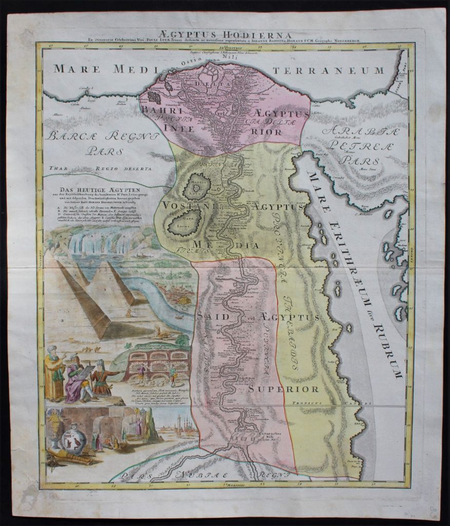
Aegyptus Hodierna Ex itinerario Celeberrimi viri Pauli Lucae, Franci desumta ac novissime repraesentata
Cartographer: J.B. Homann (Germany)
Date: ca 1750
Handcolored (modern) Copperengraving
Condition: Very Goo
size Image: ca 47 x 56 cm
Price: 275
xxxxxxxxxxxxxxxxxxxxxxxxxxxxxxxxxxxxxxxxxxxxxxxxxxxxxxxxxxxx
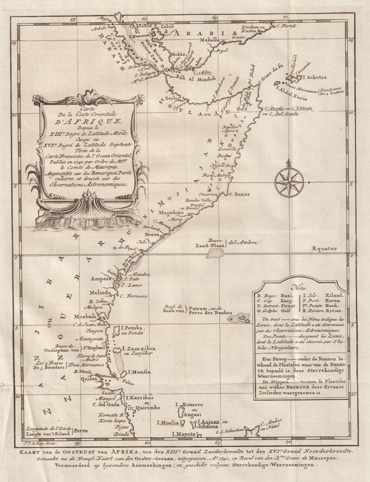
Kaart van de Oostkust van Afrika
o.a. Somalië, Kenia, Tanzania en Zanzibar alsmede de Zuidelijke punt van het Arabische schiereiland. Jemen met Aden.
Kopergravure door J, van Schley en
Cartograaf: Jacques Nicolas Bellin (1703 – 21 March 1772)
From: Antoine-François Prevost’s monumental 20 volume edition of L`Histoire Generale des Voyages.
Condition: overall good condition, folded as published
Size: ca 25,5 x 19,5 cm
Price: € 85
xxxxxxxxxxxxxxxxxxxxxxxxxxxxxxxxxxxxxxxxxxxxxxxxxxxxxxxxxxxxx
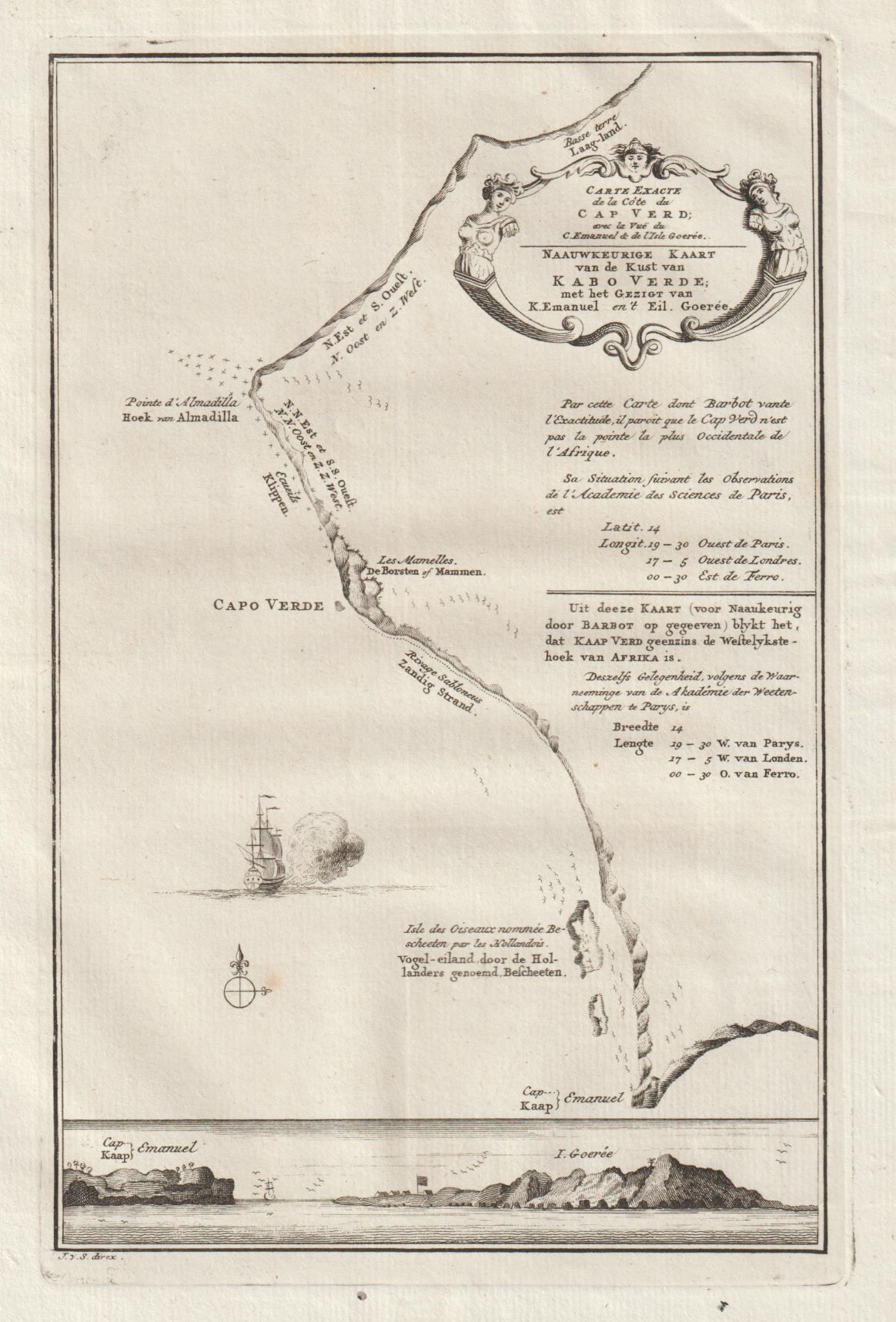
Naauwkeurige kaart van (een deel van )de kust van Kabo Verde
Kaap Verdië
Door: J. van Schley
Cartograaf: Jacques Nicolas Bellin (1703 – 21 March 1772)
From: Antoine-François Prevost’s monumental 20 volume edition of L`Histoire Generale des Voyages.
Afmeting ca: ± 21,5 x 14 cm
Condition: Excellent
Price: € 35
xxxxxxxxxxxxxxxxxxxxxxxxxxxxxxxxxxxxxxxxxxxxxxxxxxxxxxxxxxxx
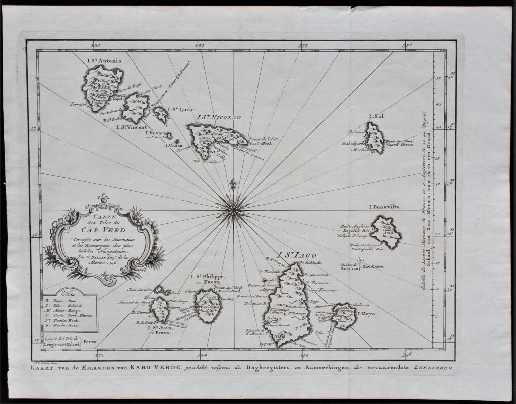
Carte cdes Isles du Cap Verd
Kaap Verdië
Door: J. van Schley
Cartograaf: Jacques Nicolas Bellin (1703 – 21 March 1772)
From: Antoine-François Prevost’s monumental 20 volume edition of L`Histoire Generale des Voyages.
Afmeting ca: ± 28 x 21 cm
Condition: Excellent
Price: € 70
xxxxxxxxxxxxxxxxxxxxxxxxxxxxxxxxxxxxxxxxxxxxxxxxxxxxxxxxxxxxx
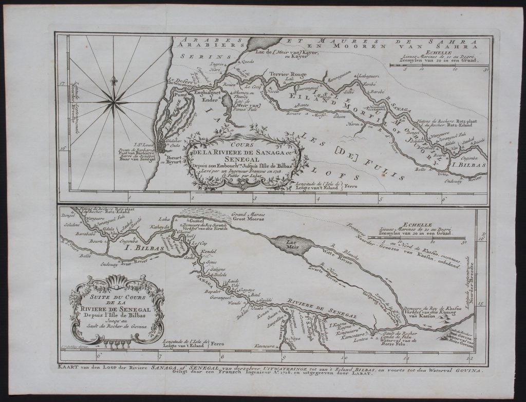
Cours de la Rivière de Sanaga ou Sénégal depuis son embouchre. jusqu’a l’Isle de Bilbas // Suite du cours de la Rivière de Sanaga ou Sénégal depuis d’Isle de Bilbas jusqu’au sault du Rocher de Govina
[Course of the Senegal River from its mouth to the Isle of Bilbas // Continuation of the course of the Senegal from the Isle of Bilbas to Gouina Falls ]
Door: J. van Schley
Cartograaf: Jacques Nicolas Bellin (1703 – 21 March 1772)
From: Antoine-François Prevost’s monumental 20 volume edition of L`Histoire Generale des Voyages.
Condition: Excellent, with fold as published
Size: 23.0 x 30.0cm
Price: € 60
xxxxxxxxxxxxxxxxxxxxxxxxxxxxxxxxxxxxxxxxxxxxxxxxxxxxxxxxxxxxxx
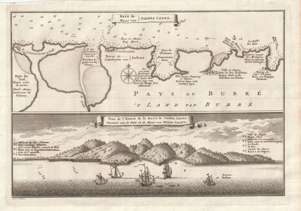
Kaart van de Baai van Sierra Leone met kustprofiel / Baye de Sierra Leone
Fraai kaart met Nederlandse legenda / French text
Graveur: J. van Schley
Cartograaf: J.N. Bellin
Datering: ca 1747
Size image: ca 22,5 x 15 cm
Condition: Excellent
Price: € 45
xxxxxxxxxxxxxxxxxxxxxxxxxxxxxxxxxxxxxxxxxxxxxxxxxxxxxxxxxxxxxx
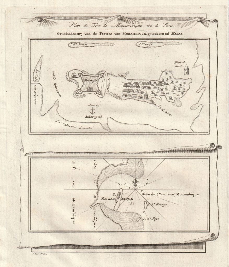
Grondtekening van de fortres van Mozambique / Plan de fort de Mozambique
Engraving by: J. van Schley
Cartographer: J.N. Bellin
Date: ca 1747
size image: ca 16 x 19 cm
Condotion: Excellent
Price: € 25
xxxxxxxxxxxxxxxxxxxxxxxxxxxxxxxxxxxxxxxxxxxxxxxxxxxxxxxxxxxxxx